-
Lipton Property
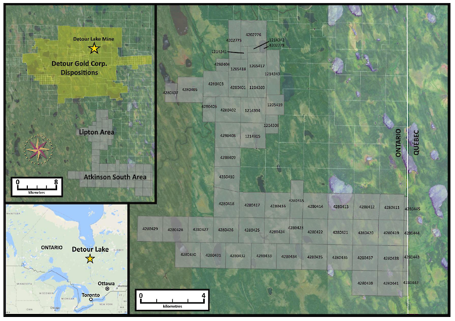
Size12,425 hectares, 57 legacy claims consisting of 721 Cell Claims, 563 Single Cell Mining Claims, 143 Boundary Cell Mining Claims, and 30 "internal" and overlapping (i.e., two occupying the same space) Boundary Cell Mining ClaimsTargetQuartz-carbonate vein systemAccessWinter Road/Logging roadsLocationAbitibi greenstone belt, south of the Lower Detour deformation zone 150 km northeast of Cochrane, ON in the Porcupine Lake Mining Division 3 km south of Detour Gold’s 58N high grade gold discoveryProject Highlights
Two zones of anomalous gold concentrations have been identified in historical exploration drilling on the Lipton property. The highest historical gold concentrations are coincident with the contact between sediments and felsic tuffs. Significant intersections from historical programs include 10.7 g/t Au over 9.0 metres, reported by Better Resources Ltd. in 1996; and 14.10 g/t Au over 7.7 metres, reported by Dentonia Resources Ltd. 2006.
Geology
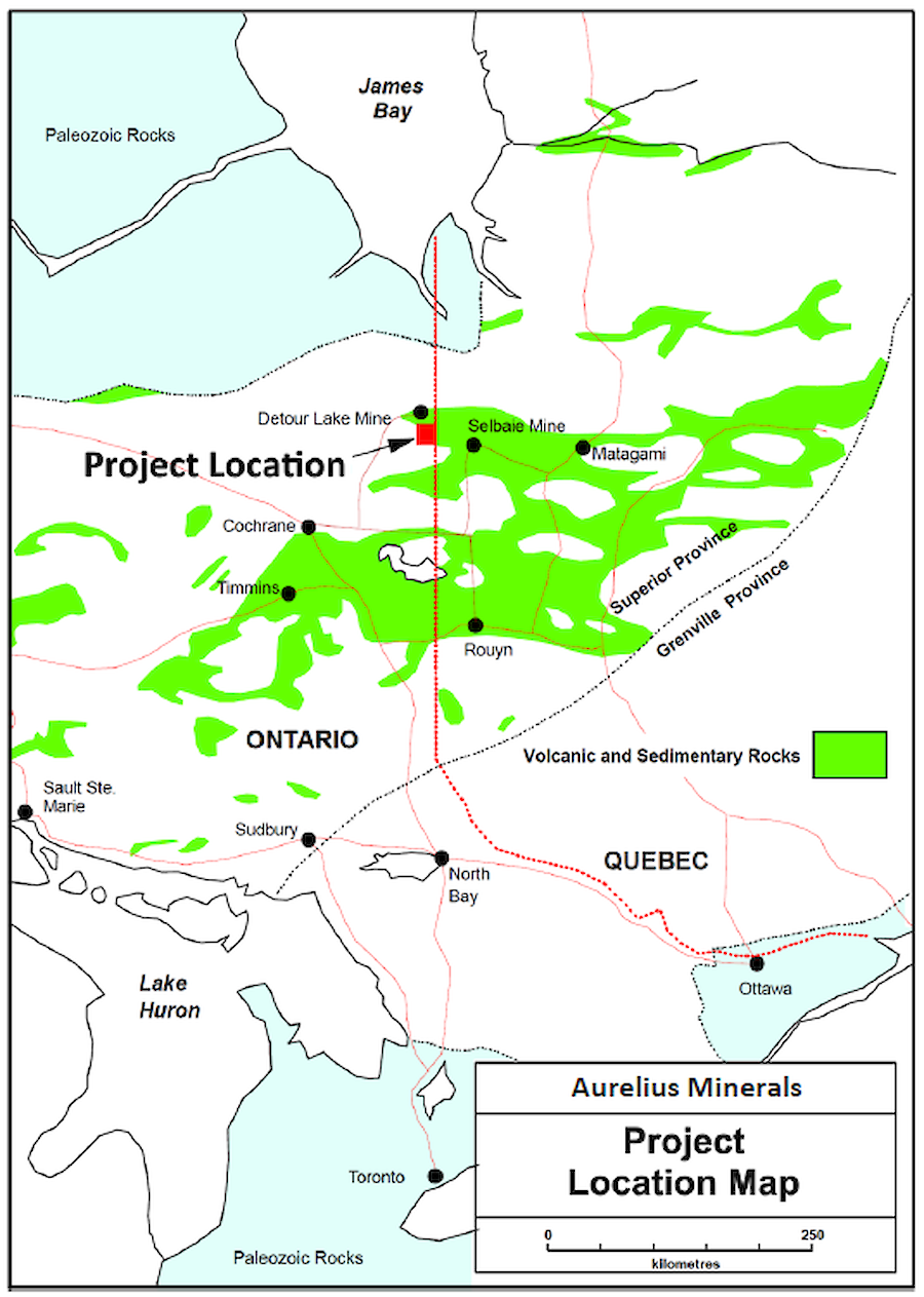
The Project is located in the northern portion of the Abitibi Greenstone Belt and is underlain by Archean-aged volcanic, sedimentary, and intrusive rocks which have been regionally metamorphosed from greenschist to amphibolite facies. In the overall Detour-Atkinson Lake Area the volcanic-sedimentary sequence consists primarily of basal felsic to intermediate volcanic rocks, overlain by a thin clastic sedimentary unit which is in turn is overlain by mafic to intermediate flows and pyroclastics. This sequence is capped by a mixed succession of felsic to intermediate volcanic rocks, mafic volcanic rocks, and clastic sediments. Intermittent graphitic and cherty horizons occur, primarily at the contacts between major units, as well as near the top of the stratigraphic sequence. This cap succession has been intruded by mafic to intermediate intrusive rocks and later by diabase dykes. The surrounding basement consists of quartz-monzonite batholiths.
The volcanic-sedimentary sequence is interpreted to have been subjected to at least two phases of deformation. The most prominent/obvious feature identified to date is an antiformal structure in the Lipton Lake Area that trends east-west, and is located south of the Detour Lake mine by about 13 kms, and south of Detour Gold’s 58N Zone by about 5 km. The fold appears to plunge at 35 to 45 degrees to the west. Additional folding and deformation is suggested by airborne magnetic results in the Atkinson Lake Area.
The region has been extensively covered by up to 35 m of Pleistocene age glacial overburden deposits that consist of tills, varved clays, silt, and gravel.
Mineralization
Two zones of anomalous gold concentrations have been identified in drilling in the Lipton area, they are known as the Contact Zone and the M1 Zone. The highest gold values have been found in the Contact Zone, coincident with the contact between sediments and felsic tuffs. This Zone appears structurally controlled, and dips to the north and west at approximately 20°, which is sub-parallel to the geology. Thicknesses encountered range from 1 to 10 metres and can be traced for approximately 330 metres.
The M1 Zone is approximately 60 metres above the Contact Zone and is hosted in mafic volcanics. The M1 ranges in thickness from 1 to 9 metres and can be traced for approximately 300 metres.
Ownership
The Company owns 100% of 44 of the claims and is working towards earning 100% interest (subject to a 2% NSR) in the remaining 13 claims from a private owner.
Maps & Photos
Technical Report
Projects
Subscribe for Updates
Register to receive news via email from Aurelius Minerals Inc.
* Required Fields